
Dc0300s-MC-016
Dublin Core
Title
Dc0300s-MC-016
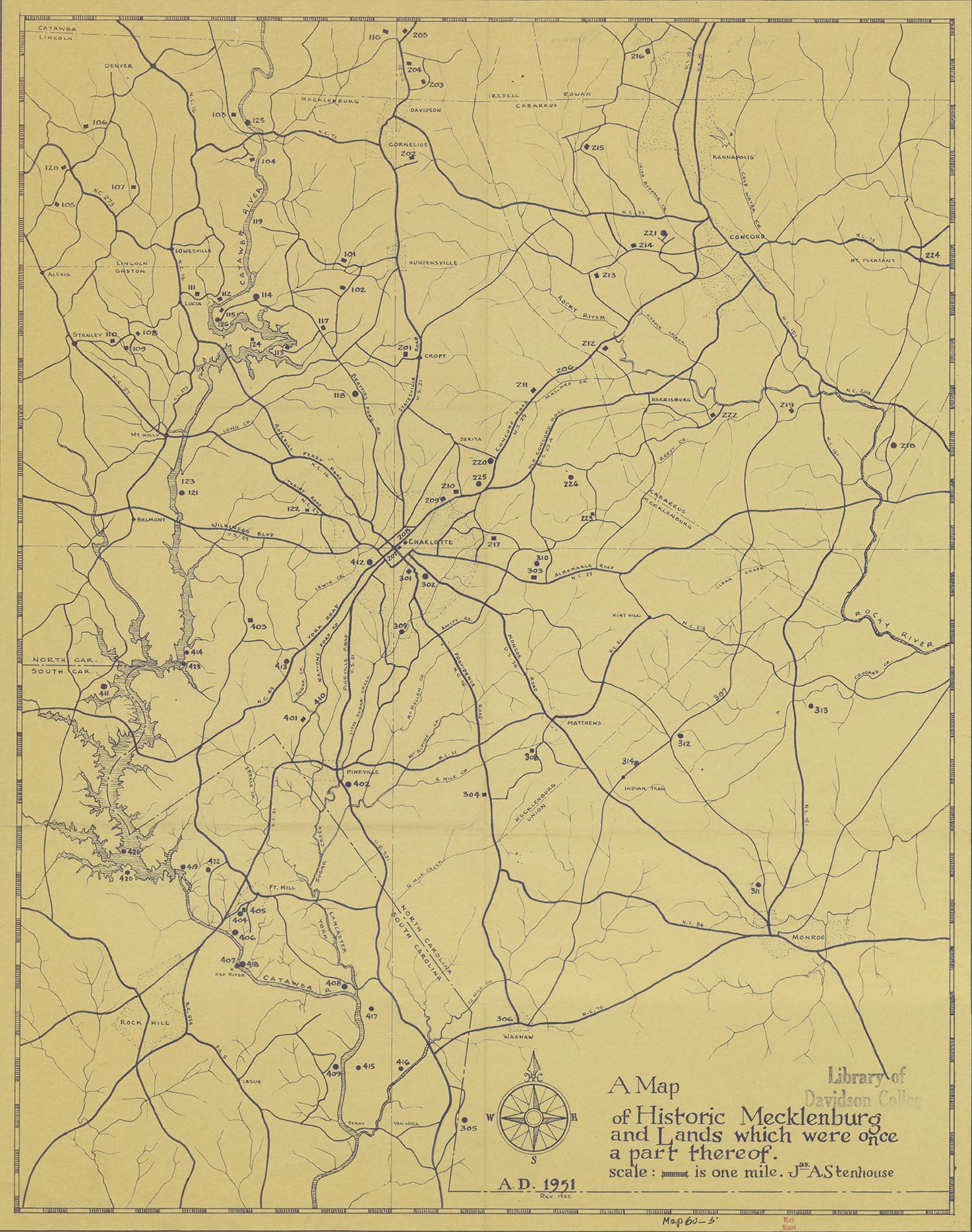
Map of Historic Mecklenburg and Lands which were one a part thereof.
Subject
North Carolina - Mecklenburg County
Description
Map of Mecklenburg County showing Catawba River and parts of Union, Cabarrus, and Lincoln counties.
Creator
James. A. Stenhouse
Publisher
Davidson College
Date
1952
Rights
For information about reproducing image, contact archives@davidson.edu
Format
jpg/493 KB
Language
English
Type
Image
Identifier
DC0300s-MC-016
Coverage
4049696
Still Image Item Type Metadata
Original Format
Paper
Physical Dimensions
27" x 22'
Files
Collection
Citation
James. A. Stenhouse, “Dc0300s-MC-016,” Davidson Archives & Special Collections, accessed October 18, 2026, https://davidsonlibraryexhibits.net/archives/items/show/845.